 Here are the details of maps for Carfin:

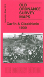
This detailed map covers the Carfin and Cleekhimin area, north of Motherwell. Coverage extends from Jerviston House eastward to Carfin Grotto, and from Beechworth Drive southward to Coursington Bridge. A major feature is the Carfin Grotto, developed as a place of pilgrimage from the 1920s. Apart from Cleekhimin and Carfin, with their housing developments, features include several railways: the LMSR 'Wishaw Deviation', with a siding to Carfin Boiler Works and other mineral lines, Carfin Halt, plus a portion of the Jerviston Line. Other features include Jerviston House, Colville Park Golf Course, Clapperhow, old mine workings, Glenburn Grounds. We include extracts from a Motherwell trade directory on the reverse, together with a timetable for the Holytown-Morningside branch.
You might find this index map useful. The map links up with Sheets 12.06 Holytown to the north, 12.09 Motherwell North to the west, and 12.14 Motherwell East to the south.