Old Ordnance Survey Maps of Glasgow NE


We have published more than 2,000 maps in our series of Old Ordnance Survey Map reprints; this includes more than a hundred in Scotland, with a growing range of maps around Glasgow. The maps are highly detailed. They are taken from the OS 1:2,500 (or 25 inch) maps and reduced to about 15 inches to the mile. Each covers an area of a mile and a half by a mile. They show streets with individual houses, tram tracks, railway tracks and even signals, factories, wharves and such details as fountains and water troughs. They will provide hours of fascination for historians and genealogists. The maps are neatly folded and each includes a specially written introduction to the area. Maps can be purchased on our On-line Mapshop where further information about titles is given. Or visit The Index Page for a full list to the series and details of Prices.


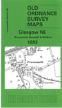
Here are the details of maps for Glasgow NE:

  • Lanarkshire Sheet 6.08 Glasgow NE (Provanmill, Blackhill & Riddrie) 1893 - published 1999; introduction by Gilbert Bell

    This detailed map covers a mixed area of NE Glasgow, much of it covering countryside about to be swallowed up by Glasgow's expansion. Coverage stretches from Blochairn Works (in the SW corner) northward to Provanmill and eastward to Hogganfield church and bleach works. Other features include Barlinnie Prison, Riddrie Vale, Monkland Canal with Blackhill Locks, Provanmill Distillery, Germiston Mains, Eclipse Works. Railways include the CR's Glasgow Lines, Blochairn Branch, and Glasgow Garnkirk & Coatbridge Branch, but with little population on the map there are no stations. On the reverse we include an extract from the earlier 1st Edition map, showing the area around Blackhill and Barlinnie in 1858.


    You might find this index map useful. The map links up with Sheets 6.07 St Rollox to the west, 6.12 Glasgow East to the east.


    Follow this link for a complete list of our Lanarkshire maps.

    You can order maps direct from our On-line Mapshop. For other information and prices, and other areas, go to The Index Page.


    Maps in the Godfrey Edition are taken from the 25 inch to the mile map and reduced to about 15 inches to the mile. For a full list of maps for Scotland, return to the Scotland page.

    The Godfrey Edition / godfreyedition@btinternet.com / 1 January 2007