
 Here are the details of maps for Partick:

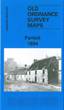
This detailed map covers an area which largely retained its independence, as Partick police burgh, but it was absorbed by Glasgow in 1912. Coverage stretches from Bures Road and Saltoun Street westward to Balshagray Avenue, and from Westbourne Gdns southward to Yorkhill station. Partick's population rose from 1,235 in 1820 to almost 70,000 by the early 20th century and this map portrays a busy centre along Dumbarton Road. Features include the River Kelvin and a small part of the Clyde, with Meadowside Shipbuilding Yard and nearby graving dock, Pointhouse Shipbuilding Yard, Partickhill, NBR Stobcross Branch with Partick station, Hyndland Branch with Hyndland station, Western Infirmary, Partick Saw Mills, Lanarkshire & Dumbartonshire Railway under construction, part of Victoria Park, Broomhill Drive. Top right, within Glasgow, is Dowanhill, with Hyndland church, observatory. Extracts from a street directory are included.
You might find this index map useful. The map links up with Sheets 6.01 Kelvinside to the north, 6.06 Hillhead to the east, 6.09 Govan to the south.