
 Here are the details of maps for Kelvinside:

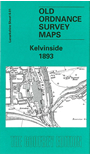
This very detailed map covers an area of NW Glasgow, together with smaller portions of Renfrewshire and Dumbartonshire. Gilbert Bell describes it as an area where "one can almost sense the energy of a great city undergoing dramatic change. Fields await development. Roads are laid out in the full expectation that buildings will soon line them. A railway is under construction and gas works ooze power for home and factory.... Glasgow in 1893 was growing spectacularly. Everything shown here within the city boundary had only been annexed in 1891 and everything beyond that boundary would be annexed in 1912." There is no central feature to the map, which includes part of Kelvinside (bottom right), part of Maryhill (top right), extends westward to the then city boundary and includes, within Renfrewshire, parts of Jordanhill and Anniesland, here largely undeveloped. But there is much of interest on the map. There are several railways, including the Stobcross Branch with Great Western Road station, part of the CR's Glasgow Central Line, the Forth & Clyde Canal, Kelvindale Paper Works, River Kelvin, Gas Works No 2 and 4, Beaconsfield Road and Montgomerie Crescent, Royal Lunatic Asylum, Claythorn, old ironstone pits, Temple of Garscube. On the reverse we include street directory extracts for Great Western Terrace and Montgomerie Drive, plus a railway timetable for the NBR's Maryhill/Singer to Bridgeton Cross line in 1918.
You might find this index map useful. The map links up with Sheets 6.02 Maryhill to the east, 6.05 Partick to the south.