Old Ordnance Survey Maps of Lincolnshire

  • These detailed maps normally cover an area of about one and a half miles by one mile. Each map includes an introduction.
  • They are available through our On-line Mapshop

  • Here are the details of maps for Bourne:

  • Lincolnshire Sheet 140.07 Bourne 1929 - published 2006; introduction by Barrie Trinder. ISBN.978-1-84151-943-2

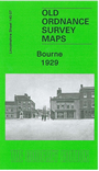
    This detailed map is double-sided to give maximum coverage of this Lincolnshire market town. The main map covers the area from the Market Place westward. Features include West Street, North Street, Town Hall, station, Well Head House (or workhouse), site of castle, malthouses, Manor House, Woodview, Bourne Camp (Ministry of Labour Training Centre). Coverage extends west to Bourne Wood and Auster Wood. On the reverse we include a good portion of adjacent sheet 140.08 covering the eastern half of the town, including St Peter & St Paul's church, Victoria Place, railway junction, site of Abbey, Hereward Estate, The Austerby, Eastgate, cemetery, Willoughby Road, Abbey Road, Car Dike.


  • Follow this link for a complete list of our Lincolnshire Series maps.
  • You can order maps direct from our On-line Mapshop. For other information and prices, and other areas, go to The Index Page.
  • Maps in the Godfrey Edition are taken from the 25 inch to the mile map and reduced to about 15 inches to the mile. For a full list of maps for England, return to the England page.
    Alan Godfrey Maps, Prospect Business Park, Leadgate, Consett, Co Durham, DH8 7PW / sales@alangodfreymaps.co.uk / 25 November 2016