Old Ordnance Survey Maps of Lincolnshire

  • These detailed maps normally cover an area of about one and a half miles by one mile. Each map includes an introduction.
  • They are available through our On-line Mapshop

  • Here are the details of maps for Brigg:

  • Lincolnshire Sheet 19.16 Brigg 1906 - published 2000; introduction by Nick Lyons. ISBN.978-1-84151-180-1

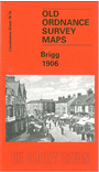
    This detailed map covers the north Lincolnshire town of Brigg, well known as the setting for Delius's tone poem Brigg Fair. The town's full name is Glanford Brigg, remembered on the map as the name for the Union. The map covers most of the town and features here include Old River Ancholme, New River Ancholme, station, Bigby Street, Wrawby Street, Market Place, workhouse, Yarborough Oil Mills, Bridge Street, Candley Beck, Island Carr, sweet manufactories, isolation hospital etc. On the reverse we include a 1905 directory.


  • Follow this link for a complete list of our Lincolnshire Series maps.
  • You can order maps direct from our On-line Mapshop. For other information and prices, and other areas, go to The Index Page.
  • Maps in the Godfrey Edition are taken from the 25 inch to the mile map and reduced to about 15 inches to the mile. For a full list of maps for England, return to the England page.
    Alan Godfrey Maps, Prospect Business Park, Leadgate, Consett, Co Durham, DH8 7PW / sales@alangodfreymaps.co.uk / 25 November 2016