
 Here are the details of maps for Scunthorpe:

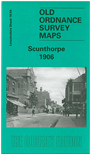
This detailed map covers the Lincolnshire steel town of Scunthorpe and is double-sided for maximum coverage. The main map covers the town centre from the cemetery eastward and features include the High Street, Chapel Street, Market Hall, Manley Street, station, Scunthorpe Vicarage, Oswald Farm, St John's church, Highfield, Lindsey Iron Works (disused), Frodingham Iron & Steel Works, Trent Iron Works, windmill, part of North Lincolnshire Iron Works (in lower right corner), North Lindsey Light Railway with engine shed and station, many railway sidings and tracks to ironstone quarries. On the reverse we include a section of adjacent sheet 18.03 covering the rest of the town centre, part of Frodingham incl St Lawrence's church, and part of Crosby. A commercial directory is also included.