
 Here are the details of maps for Canterbury:

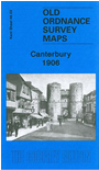
This detailed and busy map covers most of central Canterbury, with coverage stretching from the Cemetery and London Road eastward to Longport Street and the Barracks, and from Hanover Road southward to Gordon Road.
Features include city centre with individual buildings neatly shown, Cathedral, both railway stations with approaches, Harbledown Junction, Danejohn Mound, City Wall, St Gregory's church, St Mildred's church, remains of St Augustine's Abbey, Missionary College, Infantry Barracks, Artillery Barracks, Holy Cross church, St Dunstan's church, brewery, St Peter's church, Dean's Mill, Agricultural Hall, St Mildred's Tannery, Simon Langton Schools, Ersham House, Kent & Canterbury Hospital, St George the Martyr's church, etc. On the reverse we include a directory of city and cathedral officials.