Old Ordnance Survey Maps of Kent

  • These detailed maps normally cover an area of about one and a half miles by one mile. Each map includes an introduction.
  • They are available through our On-line Mapshop

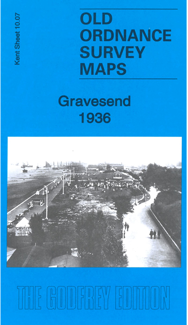
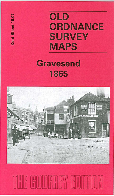
  • Here are the details of maps for Gravesend:

  • Kent 10.07a Gravesend 1865 - published 2001; intro by Alan Godfrey. ISBN.978-1-84151-237-2
  • Kent 10.07b Gravesend 1936 - published 2023; intro by Pamela Taylor. ISBN.978-1-78721-610-5

    We have published two versions of this busy map, showing how the area changed across the years.

    The detailed map covers much of Gravesend town centre, with coverage extending eastward to Denton and Westcourt Marshes.

    Features include town centre with individual buildings neatly shown, Town Pier, Fort Gardens, Gravesend Barracks, Windmill Hill, railway with station (at extreme left of map), Holy Trinity church, St George's church, Market Place, St Andrew's church, Thames & Medway Canal with Canal Basin, Thames Ironworks, Denton, St Peter & St Paul's church, Isolation Hospital etc

    The map links up with 10.06 Northfleet to the west.

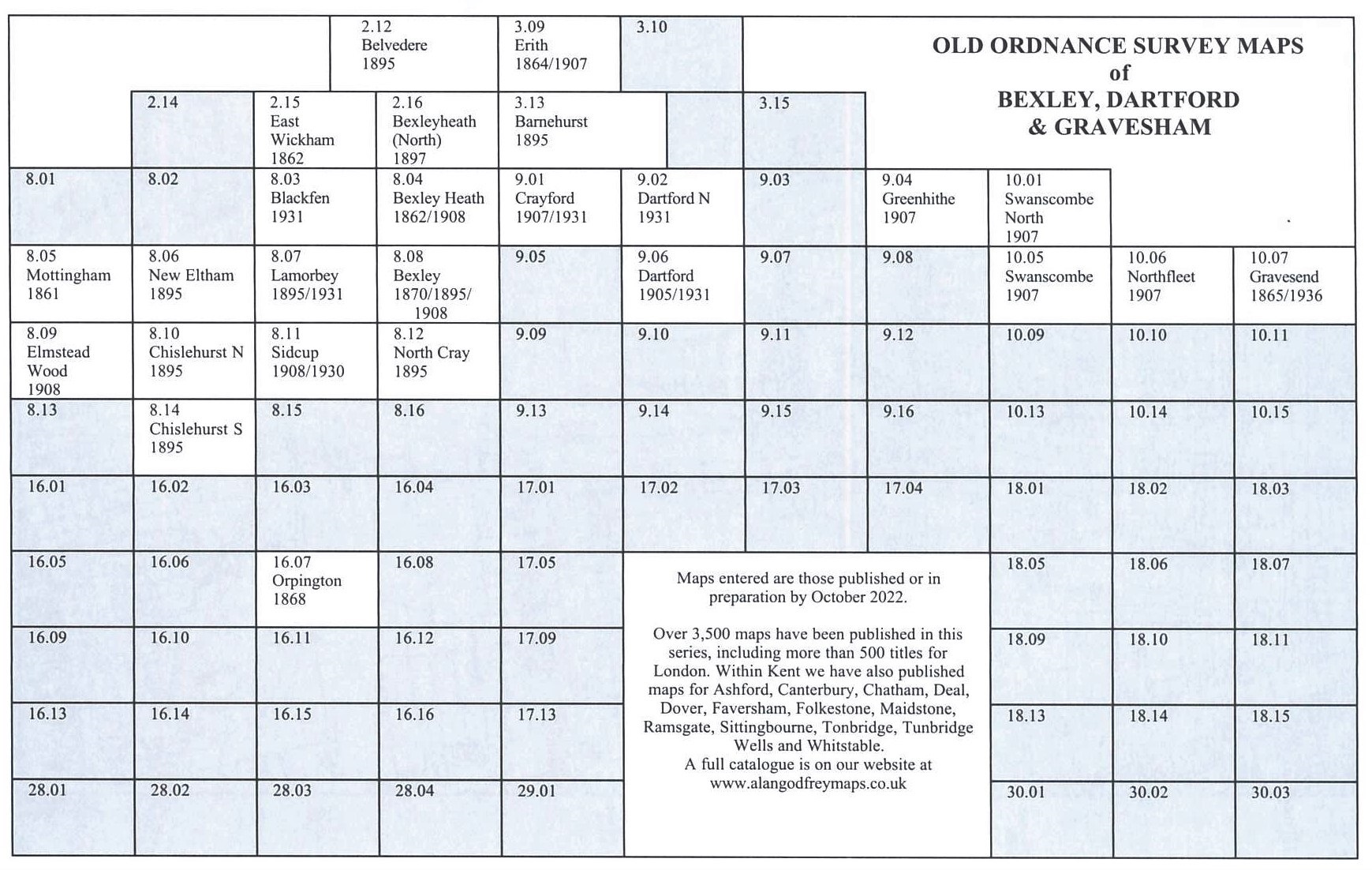
    You might find this Index Map useful.


  • For other maps in Kent see our Kent page.
  • You can order maps direct from our On-line Mapshop. For other information and prices, go to The Index Page.
  • Maps in the Godfrey Edition are taken from the 25 inch to the mile map and reduced to about 15 inches to the mile. For a full list of maps for England, return to the England page
    The Godfrey Edition / sales@alangodfreymaps.co.uk / 29 December 2022