Old Ordnance Survey Maps of Farnborough


We have published more than 1,900 maps in our series of Old Ordnance Survey Map reprints, including groups in Hampshire and Wiltshire. The maps are highly detailed. They are taken from the OS 1:2,500 (or 25 inch) maps and reduced to about 15 inches to the mile. Each covers an area of a mile and a half by a mile. They show streets with individual houses, tram tracks, railway tracks and even signals, factories, wharves and such details as fountains and water troughs. They will provide hours of fascination for historians and genealogists. The maps are neatly folded and each includes a specially written introduction to the area. Maps can be purchased on our On-line Mapshop where further information about titles is given. Or visit The Index Page for a full list to the series and details of Prices.


Here are the details of maps for Farnborough & Cove:

  • Hampshire Sheet 13.13 Farnborough 1930 - published 2003; introduction by Tony Painter. ISBN 1-84151-582-5

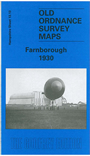
    This very detailed map is double-sided to provide maximum coverage and provides busy coverage of a varied town: part old settlement close to the drove road, part residential growth due to the station, but largely due to military expansion. The main map covers the area from St John's church West Heath eastward to St Michael's Abbey, and from Farnborough Hill Convent School southward to Hillside College. Features include Cove, Cove Bungalows, Rafborough, Cove Green, Pinehurst Barracks, station, military line (closed 1968), North Farnborough, Forest Lodge, Tumble Down Dick Hotel. On the reverse we include part of adjacent sheet 13.14 extending coverage eastward to the county boundary. Features here include Farnborough Park, Avenue Road, Farnborough Court and the southern part of the area known as Farnborough Street. The introduction by Tony Painter explains the growth of Farnborough, including Samuel Franklin Cody whose "long hair and colonial manner did not fit the traditional military image" but whose confident manner showed there was a future in 'powered kites' and ultimately aeroplanes.


    Follow this link for a complete list of our Hampshire Series maps.

    You can order maps direct from our On-line Mapshop. For other information and prices, and other areas, go to The Index Page.


    Maps in the Godfrey Edition are taken from the 25 inch to the mile map and reduced to about 15 inches to the mile. For a full list of maps for the South West, return to the South West page.

    The Godfrey Edition / godfreyedition@btinternet.com / 5 February 2006