
 Here are the details of maps for Shoeburyness:

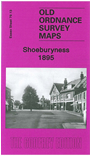
This detailed map covers the military town of Shoeburyness, which grew up around the garrison, with its Special School of Gunnery and military experiments. Our map has rather a lot of sea, but the core of Shoeburyness is covered, from Cambridge Road southward to the tip of Shoebury Ness. Features include Artillery Barracks, Cambridge Town, St Andrew's church, High Street, tramway into the barracks, rifle range, South Shoebury Hall, chapel, and just the tip of Shoeburyness station. On the reverse we include directories of South Shoebury in 1895 and 1922.