
 Here are the details of maps for Seaton Carew:

Seaton Carew is a small seaside resort just south of Hartlepool. By the late 18th century it was being developed by Quakers from Darlington, but it never developed beyond a village, with 50 or 60 houses by 1812. Later it grew following the development of West Hartlepool, of which it became part in 1882. Our map covers almost all this small resort, and extends westward to Stranton Grange and Cold Knuckles, still an area of open countrryside in the 1890s. Features on the map include the station, Holy Trinity church, The Green, Staincliffe. On the reverse we include a map showing the village in 1914, by which time Carr House railway sidings are encroaching on the map. A directory of Seaton Carew in 1894 is also included, from Whelan's Directory.
The map links up with Sheet 37.15 Stranton to the north.
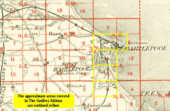
You might find this index map useful.