Old Ordnance Survey Maps of Sunderland

  • These detailed maps normally cover an area of about one and a half miles by one mile. Each map includes an introduction.
  • They are available through our On-line Mapshop

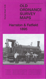
  • Here are the details of maps for Harraton:

  • Co Durham Sheet 13.06 Harraton & Fatfield 1895 - published 2017; intro by Alan Godfrey. ISBN.978-1-78721-046-2

    This very detailed map covers the Harraton area of what is now Washington, part of Sunderland. Parts of Fatfield and Rickleton are also included.

    Features include St George's Fatfield church, Harraton Colliery, Nova Scotia, Pontop & South Shields railway, Harraton Wagonway, High Chartershaugh, Haggis Hall, and several old pits and wagonways. Harraton Colliery was traditionally called 'Cotia Pit. The northern section of Lambton Park is also included.

    Extracts of Whellan's and Kelly's directories are included on the reverse..

    The map links up with Sheet 13.07 Penshaw to the east.


  • Follow this link for a complete list of our Sunderland maps.
  • You can order maps direct from our On-line Mapshop. For other information and prices, and other areas, go to The Index Page.
  • Maps in the Godfrey Edition are taken from the 25 inch to the mile map and reduced to about 15 inches to the mile. For a full list of maps for the North East, return to the North East page.
    The Godfrey Edition / sales@alangodfreymaps.co.uk / 25 October 2017