Old Ordnance Survey Maps of Dunbartonshire
These are the maps we publish for Dunbartonshire. Each map includes an introduction.
They are available through our On-line Mapshop
Dunbartonshire, or County of Dumbarton, is one of Scotland's historic counties. It was abolished in 1975 when it became part of Strathclyde.
This page includes the maps for West Dunbartonshire and East Dunbartonshire, the two unitary authorities formed in 1996.
See This Page for more information on the area's local government history.
 These are the maps we publish in Dunbartonshire:
The following Lanarkshire maps are now in East Dunbartonshire:
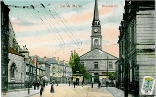
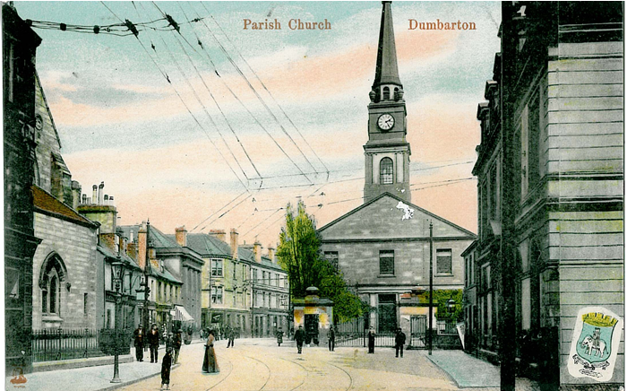
- Lanarkshire 01.15 Bishopbriggs 1910 - published 1998; intro by Gilbert Bell
- Lanarkshire 02.09 Lenzie 1897 - published 1994; intro by Don Martin
 Most maps in the Godfrey Edition are taken from the 25 inch to the mile map and reduced to about 15 inches to the mile.
For a full list of maps for Scotland, return to the Scotland page
You can order maps direct from our On-line Mapshop.
This list shows all our maps for the county. We try to keep a full range in print but inevitably some titles fall out of print from time to time.
These are noted in our On-line Mapshop.
Most maps in the Godfrey Edition are taken from the 25 inch to the mile map and reduced to about 15 inches to the mile.
For a full list of maps for Scotland, return to the Scotland page
You can order maps direct from our On-line Mapshop.
This list shows all our maps for the county. We try to keep a full range in print but inevitably some titles fall out of print from time to time.
These are noted in our On-line Mapshop.
Alan Godfrey Maps, Prospect Business Park, Leadgate, Consett, DH8 7PW. Tel 01207 583388
The Godfrey Edition / sales@alangodfreymaps.co.uk / 6 November 2016
 These are the maps we publish in Dunbartonshire: