
 Here are the details of maps for Dover:

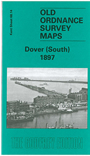
This detailed map is packed with information despite two drawbacks. The Castle and Western Heights are left blank for security reasons, both being in military use at the time. But the map covers the area from Biggin Street southward to the harbour and has much fascinating detail. Features include the Priory, Harbour and Town stations; The Harbour, Granville Basin, Wellington Basin, Pier (under construction), Promenade Pier, Waterloo Crescent, Marine Parade, East Cliff Terrace, Granville Gardens, Market Square, St James church, Clarendon Street, Christ Church, tramways. The map will be of especial interest to transport historians showing a dock area, with its two stations, that has changed so much.