
 Here are the details of maps for Coventry in our Warwickshire series:


The maps link up with each other; here are brief details of each:
The Coventry North map covers an area around Foleshill Road and Stoney Stanton Road,with coverage stretching from Harnall Lane East northward to Great Heath, Paradise and Highfield Street; and from Sandy Lane eastward to Stoke Heath and Barras Heath. Features on this very busy map include the Coventry Canal, tramways and tram depot, mineral railway leading to ordnance factory, Bishopsgate Green, King Field ribbon works, Swanswell Ward, Harnall Ward, Courtauld's Artificial Silk factory, Daimler's Motor Mill, and much more. On the reverse is a section of the 1921 Directory, A-G.
The Coventry West map covers the western part of the city and is taken from the unusual Inland Revenue revision map; these were partially revised to 1911 and this makes it easy to chart the progress of the area between 1904 and 1911. Spon End is central to this map, with coverage stretching from Spon Street and St Osburg's Priory westward to Chapel Fields, Hearsall Common and, at the western edge of the map, Whoberley Hall. Features include Coundon Road station, Rudge Motor & Cycle Works, St Thomas's church. The directory continues on this map, with entries H-P, plus a timetable for the Coventry-Nuneaton railway in 1897.
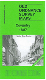
We have published two versions of the main Coventry map, showing how the area changed across the years. The 1887 version is in colour, taken from the beautiful 1st Edition OS handcoloured map. The maps cover the centre of the city (much of which, of course, was destroyed in the war). Coverage extends from Queen Victoria Road eastward to Gosford Green and Stoke Knob, and from the station (bottom left corner) northward to Drapers Field and Sackville Street. The many features include St Michael's church, Cattle Market, Maudslay Motor Works, Velox Motor Works, Kitson Works, Cheylesmore Works, Meteor motor cycle works, Triumph cycle works, Challenge Cycle Works, Singer cycle works, Premier cycle works, Coronet motor works, Sparkbrook cycle works, Dunlop works, and many more factories for cycles, motors or related trades. Also the workhouse, football ground, Pool Meadow etc. Street directory entries for Broadgate, Butcher Row, Cross Cheaping, Greyfriars Lane, High Street are also included.
The Coventry South map continues coverage south and is far less built up. The railway runs across the map while the Leamington branch runs south. Features include Whitley Common, Whitley Coal Wharf, engine shed (at Leamington Jct), St James church Stivichall. Directory entries P-Z are also included, plus a directory for the tiny village (population 81) of Stivichall.