
 Here are the details of maps for Colchester:

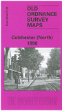
We have published a set of three maps for Colchester, covering the town in detail. Colchester (North) is centred on the main station (North station); North Station Road runs from this to the town, with North Bridge and the Cattle Market near the foot of the map. Other features include St Paul's church, Eastern Counties Asylum, and (north of the station) Bergholt Road and Mile End Road. Braiswick House is in the top NW corner.
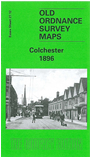
Colchester, the main map for the town, links up to the south. This is a very busy map and coverage stretches from The Avenue and Sussex Road eastward to Wimpole Lane, from the Roman Wall southward to Pownall Crescent. The town centre is covered and other features include St Botolphs station, Magdalen Street, High Street, Castle, St Johns Green, Abbey Gardens, North Hill, Head Street, East Mills, workhouse, Essex & Colchester Hospital, Lexden Road, St Marys Terrace, Cavalry Barracks, Royal Artillery Barracks, Infantry Barracks, Provost Prison, Drill Ground, Garrison church.
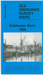
Colchester (East) covers the area to the east, and includes the docks area on the River Colne. It includes Hythe, Hythe Hill, Hythe station, Hythe Maltings, Winsleys Almshouses, Greenstead, part of Wivenhoe Park, Greenstead Road, East Street, Grays Cottages.
Each of the maps includes extracts from a contemporary street directory.
Maps in the Godfrey Edition are taken from the 25 inch to the mile map and reduced to about 15 inches to the mile. For a full list of maps for England, return to the England page.
Alan Godfrey Maps, Prospect Business Park, Leadgate, Consett, Co Durham, DH8 7PW / sales@alangodfreymaps.co.uk / 25 November 2017