Old Ordnance Survey Maps of Caithness

  • These detailed maps normally cover an area of about one and a half miles by one mile. Each map includes an introduction.
  • They are available through our On-line Mapshop

  • Here are the details of maps for Thurso:

  • Caithness Sheet 5.11 Thurso 1905 - published 2008; intro by Gilbert Bell. ISBN.978-1-84784-135-3

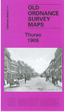
    This detailed map covers the most northerly town on the British mainland. Coverage stretches from the station northward to Thurso Castle and the Harbour. Both the old town and the 'grid-plan' new town are shown. Features include River Thurso, Fisher Biggings, Thurso Castle, church, Kirk Ebb, Brown Hill, pavement works, railway terminus (but not its approaches), Pennyland, and the town centre shown in detail with each house neatly delineated. Extracts from a contemporary trade directory are included on the reverse.


  • Follow this link for a complete list of our Highland maps.
  • You can order maps direct from our On-line Mapshop. For other information and prices, and other areas, go to The Index Page.
  • Maps in the Godfrey Edition are taken from the 25 inch to the mile map and reduced to about 15 inches to the mile. For a full list of maps for Scotland, return to the Scotland page.
    The Godfrey Edition / sales@alangodfreymaps.co.uk / 17 November 2016