We have published more than 1,800 maps in our series of Old Ordnance Survey Map reprints, some 30 of them in the Essex area. The maps are highly detailed. They are taken from the OS 1:2,500 (or 25 inch) maps and reduced to about 15 inches to the mile. They show streets with individual houses, tram tracks, railway tracks and even signals, factories, wharves and such details as fountains and water troughs. They will provide hours of fascination for historians and genealogists. The maps are neatly folded and each includes a specially written introduction to the area. Maps can be purchased on our On-line Mapshop where further information about titles is given. For other information and Prices, see Index Page.
Here are the details of maps for Chelmsford:
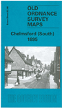
This detailed map covers the southern half of Chelmsford, from the High Street southward to Moulsham Lodge and Oaklands. Features include the Chelmer & Blackwater Canal, Moulsham Mill, Goldlay House, Baddow Road, Moulsham Street, New London Road, Mesopotamia Island, River Can, St John's church, Saltmarsh's Nursery. A list of private residents is given.
We hope to publish a map of the north of the town at a later stage.
Follow this link for a complete list of our Essex & East Anglia maps or here for our London maps.
You can order maps direct from our On-line Mapshop. For other information and Prices, see Index Page.
A small scale, Inch to the Mile map of the general area is also available here.
Maps in the Godfrey Edition are taken from the 25 inch to the mile map and reduced to about 15 inches to the mile. For a full list of maps for East Anglia, return to the East Anglia page.
The Godfrey Edition / godfreyedition@btinternet.com / 20 Nov 2005