Old Ordnance Survey Maps of Stockport (S)


We have published more than 2,100 in our series of Old Ordnance Survey Map reprints, including a large group in Lancashire & Cheshire. The maps are highly detailed. They are taken from the OS 1:2,500 (or 25 inch) maps and reduced to about 15 inches to the mile. Each covers an area of a mile and a half by a mile. They show streets with individual houses, tram tracks, railway tracks and even signals, factories, wharves and such details as fountains and water troughs. They will provide hours of fascination for historians and genealogists. The maps are neatly folded and each includes a specially written introduction to the area. Maps can be purchased on our On-line Mapshop where further information about titles is given. Or visit The Index Page for a full list to the series and details of Prices.


Here are the details of maps for Stockport (South):

  • Cheshire Sheet 19.03 Stockport (South) 1907 - published 2002; intro by Chris Makepeace

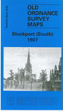
    This detailed and busy map covers the southern part of Stockport, including Heaviley, Cale Green, Shaw Heath and much of Edgeley Ward. Coverage stretches from St Thomas Place southward to Davenport station, and from Heaviley House westward to Edgeley Mount. Features include railways including Edgeley Junction, Davenport Junction, Cheadle Village Junction, Davenport station; football ground, Workhouse, St Matthew's church, Edgeley Bleach Works, Edgeley Park, tramways, Bridge Hall, Bamford Grange, Davenport Terra Cotta Works, Cale Green Park, Heaviley Mill, cemetery, Brookfield Brewery, Wellington Road South, Brookfield House, many streets of terraced houses, etc. On the reverse we include a small selection of street directory entries, incl Buckingham Street, Buxton Road, Cambridge Street, Devonshire Road, Edgeley Road, Shawcross Street.

    The map links up with Cheshire sheets 10.15 Stockport to the north and 19.02 Cheadle to the west.


    Follow this link for a complete list of our Stockport area maps.

    You can order maps direct from our On-line Mapshop. For other information and prices, and other areas, go to The Index Page.


    Maps in the Godfrey Edition are taken from the 25 inch to the mile map and reduced to about 15 inches to the mile. For a full list of maps for the North West, return to the North West page.

    The Godfrey Edition / godfreyedition@btinternet.com / 25 August 2008