 Old Ordnance Survey Maps of CaithnessOld Ordnance Survey Maps of Caithness
 We have published just two maps in Caithness, for the two principal towns. Here are the details.
All maps are available from our On-line Mapshop or from selected bookshops in the area. Each map includes a specially written introduction.
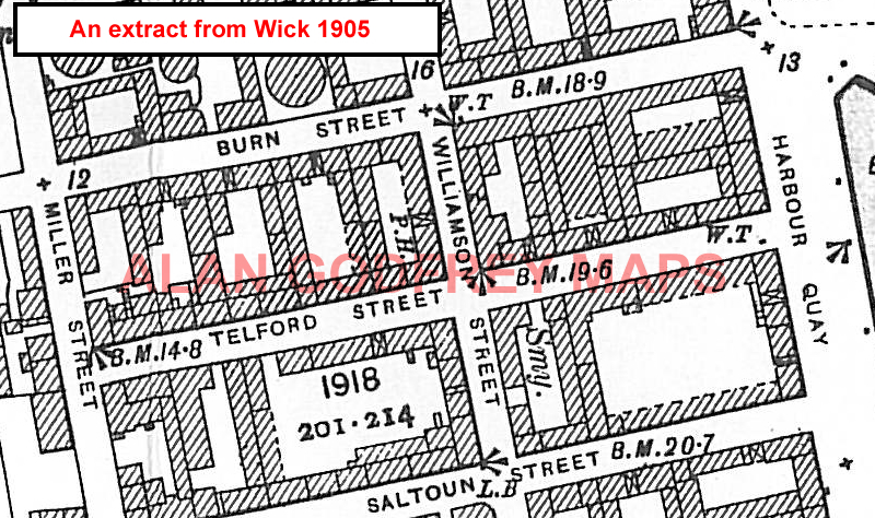
The following maps are all taken from the OS 25" maps and reduced to a scale of approximately 15 inches to the mile. They are extremely detailed, showing individual houses, details such as railway tracks, pathways, pubs, factories and even minutiae such as fountains and signal posts. Obviously they cover quite a small area, normally a mile by a mile and a half each. Click on the links below for further information on each map.
 These are the detailed maps currently available in our Caithness series:
Most maps in the Godfrey Edition are taken from the 25 inch to the mile map and reduced to about 15 inches to the mile. They cost just £ 3.00 each. For a full list of Scottish maps, return to the Scotland page
You can order maps direct from our On-line Mapshop. They are also available from various local outlets.