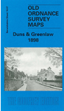
 Here are the details of maps for Duns & Greenlaw:

This title includes two maps, to provide coverage of these two small towns.
The main map covers Duns, with coverage stretching from Duns Castle eastward to Rulesmains. Most of the town is covered in detail, showing individual houses, and features include Town Hall, auction mart, Duns Law fort, Duns Castle, Boston Free Church (at foot of map), Newtown Street, other churches, drill hall, etc.
On the reverse we include part of sheet 21.12 covering the little town of Greenlaw. Features include County Hall, The Green, Greenlaw Mill, railway (but station largely cut off by sheetlines), Blackadder Water, Easter Bridge, site of castle, County Prison (disused), Wester Bridge.