
 Here are the details of maps for Biggleswade:

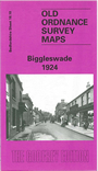
This detailed map of Biggleswade is double-sided for maximum coverage. The main map shows the northern part of the town and includes St John's Church, St Andrews Church, Cemetery, Town Hall, Market Place, High Street, Railway Line, St John's Street and Fairfield Road. On the reverse, we include part of the sheet to the south of the main map which shows the Station, Picture Theatre, Boddington House, Holme Grove and Holme Court, Motor Body Works and Brook House.