We have very good coverage for Kirklees Metropolitan Borough, which was formed in 1974 from the Dewsbury and Huddersfield County Boroughs, Batley and Spenborough Municipal Boroughs, and Colne Valley, Denby Dale, Heckmondwike, Holmfirth, Kirkburton, Meltham and Mirfield Urban Districts.
The following titles are all taken from the OS 25" maps and reduced to a scale of approximately 14 inches to the mile. Each covers an area of a mile and a half by one mile, and includes an introduction. Click on the links below for further details. All maps are available from our On-line Mapshop.
 Here are the details of maps for Meltham:
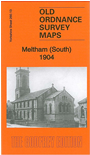
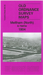

We have published a pair of maps which give good coverage of the small town of Meltham.
Sheet 260.09 covers the north of the town, with coverage extending north to the village of Helme. Features on this map include railway branch with terminus, Crosland Edge, Meltham Hall, Broadlands, Helme Hall, Fever Hospital, Upper Hey, Brigg Mills, Sefton Mills, Spinning Mill, Golcar Brow, Upper and Lower Sunny Bank Mills. This map includes a directory of Helme and a 1914 timetable for the railway branch on the reverse.
Sheet 260.13 covers the south of the town, including most of the town centre, Meltham Foundry, Albion Mill, parish church, Bent House, Calmlands, Royd Edge Dye Works, Market Place, Town Gate area, Royd Edge, Digit Works, Banister Edge, Meltham Convalescent Home, Durker Roods etc. This map includes an 1889 directory of Meltham on the reverse.