We have very good coverage for Kirklees Metropolitan Borough, which was formed in 1974 from the Dewsbury and Huddersfield County Boroughs, Batley and Spenborough Municipal Boroughs, and Colne Valley, Denby Dale, Heckmondwike, Holmfirth, Kirkburton, Meltham and Mirfield Urban Districts.
The following titles are all taken from the OS 25" maps and reduced to a scale of approximately 14 inches to the mile. Each covers an area of a mile and a half by one mile, and includes an introduction. Click on the links below for further details. All maps are available from our On-line Mapshop.
 Here are the details of maps for Dewsbury:


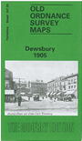
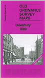
We have published two versions of this detailed map, showing how the area changed across the years. Each covers the town of Dewsbury, one of West Yorkshire's 'big six' and a county borough until 1965. Most of the town is shown, with coverage stretching from Spinkwell Mills southward to Dewsbury Mills, and from Moor Bottom eastward to Leeds Road and Wakefield Road.
The many features include Town Hall, Market Place, LNWR Leeds & Dewsbury line with station, LYR Dewsbury Branch with terminus, GNR station, LYR Ravensthorpe Branch with station at Scout Hill, River Calder, Tanhouse Chemical Works, Burgh Mills, cemetery, Headfield Mills, Saville Town, Aire & Calder basin, Town End, Calder Bank Mills, Cut End Mills, Saville Mills, Eastborough, Eightlands, The Flatts, West Town, Watergate, Daw Green, Crow Nest Park, Boothroyd with St John's church, Conyers Colliery, tramways and much more. A Midland Railway approach to the town (which became goods only) is shown as 'under construction' on the 1905 map. Each map includes extracts from a contemporary directory.
The 1889 version is fully coloured, taken from the beautiful 1st Edition OS handcoloured map.
The map links up with sheet 232.15 Staincliffe to the north, 247.02 Mirfield NE to the west, 247.04 Earlsheaton to the east, and 247.07 Thornhill Lees to the south.