
 Here are the details of maps for Salterhebble & Copley:

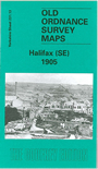
This detailed map covers an area south of Halifax which includes Salterhebble, Copley, Siddal and Exley. The Calder & Hebble Navigation runs through the map and railways include the Greetland Branch, Sowerby Bridge & Bradford line, and main L&Y line. Copley station is shown. Features include Halifax Poor Law Union Hospital, Copley Hall, Copley Mills, Long Wood, Skircoat Green, Green Royd, Skircoats Moor Road, Abbotts Ladies Home, All Saints church, Providence Chemical Works, Bottoms Mill, Upper Exley etc. On the reverse we include a selection of directory entries, incl for Salterhebble, Skircoat Green, Siddal Street, Huddersfield Road, Skircoat Green Road.
The map links up with Sheets 231.09 Halifax South to the north, 246.01Greetland to the south.
You can order maps direct from our On-line Mapshop. For other information and prices, and other areas, go to The Index Page.
Maps in the Godfrey Edition are taken from the 25 inch to the mile map and reduced to about 15 inches to the mile. Follow this link for a complete list of our Calderdale maps; or here for the whole Yorkshire series.
Alan Godfrey Maps, Prospect Business Park, Leadgate, Consett, Co Durham, DH8 7PW / sales@alangodfreymaps.co.uk / 20 Sept 2016