
 Here are the details of maps for Hipperholme:

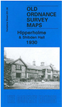
This detailed map covers the area east of Halifax, from Shibden Hall and Shibden Park eastward to Hipperholme. Features include Stump Cross, Intake Wood, tramways, LMS railway with Hipperholme station, Hipperholme Works, Hipperholme Mill, Shibden Hall Colliery, Hipperholme Brewery, Upper Brear, Hough Mills, Gardner Square Tannery etc. On the reverse we include a directory of Hipperholme, plus street entries for Staups Lane and Stump Cross.
The map links up with Sheet 231.05 Halifax North to the west.
You can order maps direct from our On-line Mapshop. For other information and prices, and other areas, go to The Index Page.
Maps in the Godfrey Edition are taken from the 25 inch to the mile map and reduced to about 15 inches to the mile. Follow this link for a complete list of our Calderdale maps; or here for the whole Yorkshire series.
Alan Godfrey Maps, Prospect Business Park, Leadgate, Consett, Co Durham, DH8 7PW / sales@alangodfreymaps.co.uk / 20 Sept 2016