
 Here are the details of maps for Farsley:

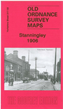
This detailed map covers most of Stanningley, between Leeds and Bradford, and a small portion of Pudsey. Coverage stretches from Lowtown Pudsey northward to Arthur Street Stanningley, and westward to Galloway Lane and Hill Foot. Features include Primrose Hill, GNR railway with Stanningley station, tramway along Bradford Road, Stanningley Iron Works, Stanningley Hall, West Royd, Providence Foundry, Upper Cape Mills, Leigh Mills, Delph Hill, Pudsey Cemetery, Prospect Mills, Owl Cotes Hill, Grove Boot Works, Wood Nook, Fieldhouse Farm etc. On the reverse we include directory entries for Richardshaw Lane and Town Street.
The map links up with Sheets 202.14 Farsley to the north, 217.01 Thornbury & Bradford Moor to the west, 217.03 Bramley to the east and 217.06 Pudsey to the south.