Old Ordnance Survey Maps of Bradford

  • These detailed maps normally cover an area of about one and a half miles by one mile. Each map includes an introduction.
  • They are available through our On-line Mapshop

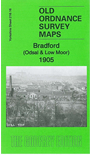
  • Here are the details of maps for Bradford (Odsal):

  • Yorkshire Sheet 216.16 Bradford (Odsal & Low Moor) 1905 - published 2014; intro by Ruth Strong. ISBN.978-1-84784-850-5

    This detailed and busy map covers the area from Odsal to the northern part of Low Moor, with coverage eastward to Bierley Hall Hospital.

    Features include Odsal Top, Truncliffe, Hill Top, part of Low Moor works, Holy Trinity church, Odsal House, Coll Place, Coll Mill, Victoria Mills, Brayshaw Fold, Park House Wire Mills, Wesley Place, railways but no station, Highfield Engine House, Woodhouse Hill, Bierley Hall Hospital etc. Street directory entries from a 1903 directory are included on the reverse.


    The map links up with sheet 216.12 Bradford (South) to the north, 217.13 East Bierley to the east, 231.04 Oakenshaw & Wyke to the south.


  • You can order maps direct from our On-line Mapshop. For other information and prices, and other areas, go to The Index Page.
  • Maps in the Godfrey Edition are taken from the 25 inch to the mile map and reduced to about 15 inches to the mile. Follow this link for a complete list of our Bradford maps; or here for the whole Yorkshire series.
    Alan Godfrey Maps, Prospect Business Park, Leadgate, Consett, Co Durham, DH8 7PW / sales@alangodfreymaps.co.uk / 15 November 2017