Old Ordnance Survey Maps of Bradford

  • These detailed maps normally cover an area of about one and a half miles by one mile. Each map includes an introduction.
  • They are available through our On-line Mapshop

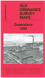
  • Here are details of the map for Queensbury:

  • Yorkshire Sheet 216.09 Queensbury 1932 - published 2012; intro by John Hargreaves. ISBN.978-1-84784-570-2

    This detailed map covers the village of Queensbury and the area north and west.

    Queensbury itself, with Black Dyke Mills, is in the SE corner of the map. Features here include tramway, Holy Trinity church, the mills, and individual buildings neatly shown. The railway is shown in tunnel. Other hamlets and settlements across the map include Mountain, Yews Green, Hill Top, Clayton Edge, West Scholes Gate, Raggalds, White Castle Brewery and the Bradshaw Lane area. On the reverse we include a 1936 directory of Queensbury and Mountain.

    The map links up with sheet 216.10 Clayton Heights to the east.


  • You can order maps direct from our On-line Mapshop. For other information and prices, and other areas, go to The Index Page.
  • Maps in the Godfrey Edition are taken from the 25 inch to the mile map and reduced to about 15 inches to the mile. Follow this link for a complete list of our Bradford maps; or here for the whole Yorkshire series.
    Alan Godfrey Maps, Prospect Business Park, Leadgate, Consett, Co Durham, DH8 7PW / sales@alangodfreymaps.co.uk / 15 November 2017