Old Ordnance Survey Maps of Yorkshire

  • These detailed maps normally cover an area of about one and a half miles by one mile. Each map includes an introduction.
  • They are available through our On-line Mapshop

  • Here are the details of maps for Acomb, York:

  • Yorks Sheet 174.09 Acomb 1907 - published 2026; intro by Martin Handley. ISBN.978-1-78721-9224-3

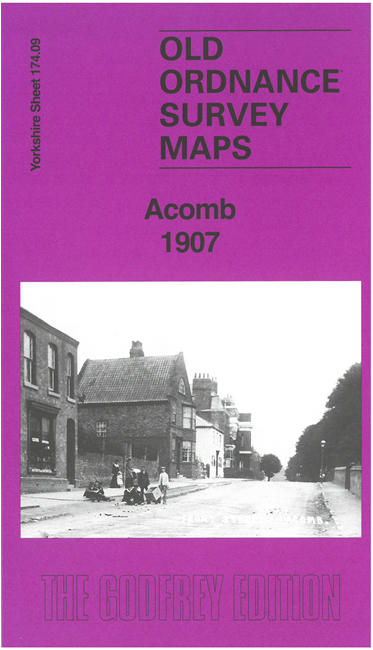
    This detailed map gives excellent coverage of the village of Acomb, just west of York.

    The many features include village centre with individual building shown, St Stephen's church, Acomb House, Acomb Hall, West Bank, Acomb Grange, etc.

    On the reverse we include a large extract from six-inch map 174SW giving wider coverage of the area, including Dringhouses and part of south York, together with a specially written introduction.

    The map links up with Yorkshire Sheet 174.10 York South to the east.


  • For other information and prices, and other areas, go to The Index Page.
  • Maps in the Godfrey Edition are taken from the 25 inch to the mile map and reduced to about 15 inches to the mile. Follow this link for a complete list of our City of York maps; or here for the whole Yorkshire series.
    Alan Godfrey Maps, Prospect Business Park, Leadgate, Consett, Co Durham, DH8 7PW / sales@alangodfreymaps.co.uk / 28 January 2026