Old Ordnance Survey Maps of Yorkshire

  • These detailed maps normally cover an area of about one and a half miles by one mile. Each map includes an introduction.
  • They are available through our On-line Mapshop

  • Here are the details of maps for Northallerton:

  • Yorkshire Sheet 56.13 Northallerton 1911 - published 2000; intro by Alan Godfrey. ISBN.978-1-84151-195-5

    This detailed map covers the county town of North Yorkshire, Northallerton. Most of the town is coverted and features include the Market Place, Town Street, Town Hall, site of Bishop's Palace, railway station (at foot of map) with High Junction and Low Junction, County Hall, Workhouse, auction marts, All Saints church, prison (blank for security reasons), goods station, Back Road. The tiny houses set back in burgage plots are a notable feature. Coverage extends east to Prospect House, Elm House, Scholla Lane. On the reverse we include a list of private residents from a 1905 directory.

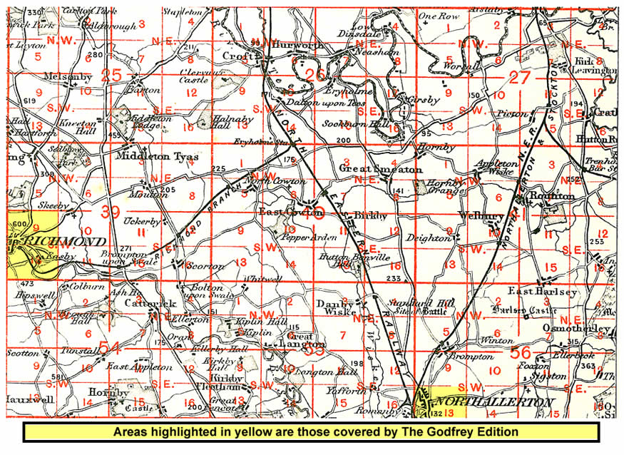
    And here is an index map showing the areas covered.


  • You can order maps direct from our On-line Mapshop. For other information and prices, and other areas, go to The Index Page.
  • Maps in the Godfrey Edition are taken from the 25 inch to the mile map and reduced to about 15 inches to the mile. Follow this link for a complete list of our North Yorkshire maps; or here for the whole Yorkshire series.
    Alan Godfrey Maps, Prospect Business Park, Leadgate, Consett, Co Durham, DH8 7PW / sales@alangodfreymaps.co.uk / 25 January 2018