
 Here are the details of maps for Hall Green:

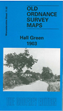
This detailed map covers the area of south Birmingham which would soon be known as Hall Green, although development had scarcely begun. In 1903 it was a largely rural area, the only piece of suburban development being around Dovey Road at the top of the map. Hall Green is in the SE quarter of the map; Stoney Lane runs down the western side.
Fairly central to the map is Sarehole Mill, the inspiration for Ted Sandyman's Mill in The Hobbit. Tolkien lived on this map for a few years. Other features include Kyotts Lake, Hall Green House (at foot of map), Green Bank, Green Bank House, Sarehole Farm, Coldbath Cottage, Coldbath Farm, Ashleigh Grange, Billesley House, part of Wake Green in top left corner. On the reverse we include street directory entries for College Road, Springfield Road, Stratford Road, Wake Green Road.
The map links up with Warwickshire sheet 14.14 Sparkhill to the north and 19.01 King's Heath to the west.