Old Ordnance Survey Maps of Warwickshire
We have a range of detailed maps for Warwickshire towns and we also cover the whole county at the Inch to the Mile scale.
Here are the details.
All maps are available from our On-line Mapshop.
Warwickshire County Council was formed in 1889. Birmingham, Coventry and (from 1964) Solihull became County Boroughs.
In 1974 Birmingham, Coventry and Solihull were transferred to the new West Midlands county. Sutton Coldfield was absorbed by Birmingham. The remainder of
Warwickshire became a 2-tier authority with five districts: North Warwickshire, Nuneaton & Bedworth, Rugby, Stratford-on-Avon, and Warwick.
For maps of Birmingham go to the Birmingham page.
See This Page for a summary of the county's local government history.
 These are our maps in Warwickshire County & Coventry:
11.09 Nuneaton 1923 published 1999; introduction by John Gough
11.13 Chilvers Coton & Attleborough 1902 publ 2002; intro by John Gough
17.05 Bedworth 1923 publ 2004; intro by Barrie Trinder
19.10 Yardley Wood & Shirley 1914 publ 2007; intro by Barrie Trinder
19.12 Solihull 1902 publ 2024; intro by Barrie Trinder
21.08 Coventry (North) 1912 publ 2006; intro by Malcolm Nixon
21.11 Coventry (West) 1904-11 publ 2006; intro by Malcolm Nixon
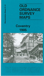
21.12a Coventry 1887 publ 2013; intro by Barrie Trinder  21.12b Coventry 1905 publ 1996; intro by Alan Godfrey
21.16 Coventry (South) 1912 publ 2006; intro by Malcolm Nixon
26.10 Kenilworth 1903 publ 2013; intro by Malcolm Nixon
28.03 Rugby (North) 1923 publ 1995; intro by Alan Godfrey
28.07 Rugby (South) 1923 publ 1995; intro by Alan Godfrey
33.10 Warwick North 1923 publ 2012; intro by Barrie Trinder
33.11 Leamington Spa 1923 publ 2003; intro by Barrie Trinder
33.14 Warwick South 1923 publ 2012; intro by Barrie Trinder
33.15 Leamington Spa (South) 1923 publ 2003; intro by Barrie Trinder
44.06 Stratford on Avon 1885 publ 2015; intro by Barrie Trinder
21.12b Coventry 1905 publ 1996; intro by Alan Godfrey
21.16 Coventry (South) 1912 publ 2006; intro by Malcolm Nixon
26.10 Kenilworth 1903 publ 2013; intro by Malcolm Nixon
28.03 Rugby (North) 1923 publ 1995; intro by Alan Godfrey
28.07 Rugby (South) 1923 publ 1995; intro by Alan Godfrey
33.10 Warwick North 1923 publ 2012; intro by Barrie Trinder
33.11 Leamington Spa 1923 publ 2003; intro by Barrie Trinder
33.14 Warwick South 1923 publ 2012; intro by Barrie Trinder
33.15 Leamington Spa (South) 1923 publ 2003; intro by Barrie Trinder
44.06 Stratford on Avon 1885 publ 2015; intro by Barrie Trinder
For Birmingham maps go to the Birmingham page
 For details of our small scale 'One Inch to the Mile' Maps visit the One Inch page. The following titles cover much of Warwickshire:
168 Birmingham & District 1910
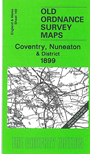
169 Coventry & Nuneaton 1899
183 Redditch & District 1907
184 Warwick & Rugby 1897
200 Vale of Evesham & Stratford 1892
201 Kineton & Banbury 1893
 Most maps in the Godfrey Edition are taken from the 25 inch to the mile map and reduced to about 15 inches to the mile.
For a full list of English maps, return to the England page
You can order maps direct from our On-line Mapshop.
Most maps in the Godfrey Edition are taken from the 25 inch to the mile map and reduced to about 15 inches to the mile.
For a full list of English maps, return to the England page
You can order maps direct from our On-line Mapshop.
Alan Godfrey Maps, Prospect Business Park, Leadgate, Consett, DH8 7PW. Tel 01207 583388
The Godfrey Edition / sales@alangodfreymaps.co.uk / 22 October 2024