
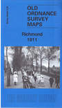
 Here are the details of the map for Richmond:

This detailed map covers the centre of Richmond.
Features include centre of Richmond with individual buildings neatly shown, St Mary Magdalene church, St Matthias church, Holy Trinity church, Hickey's Almshouses, Grove Lodge, Pesthouse Common, Richmond Union Workhouse, Wesleyan College, Buccleuch House, Cardigan House, Lancaster Park area, Sheen Park area, LSWR railway with Richmond station, Richmond Green, River Thames, Queensberry House, Hippodrome, County School and much more.
The map also includes the Twickenham Park area on the Middlesex side of the river, with features including Cambridge House, St Stephen's church, and part of Cambridge Park. Note that this Middlesex section has not been revised and is mapped as at 1894.
The map links up with sheet 6.08 Petersham to the south.
See also the Richmond 1894 map in our London series, mapped to somewhat different sheetlines.