Old Ordnance Survey Maps of Staffordshire

  • These detailed maps normally cover an area of about one and a half miles by one mile. Each map includes an introduction.
  • They are available through our On-line Mapshop

  • Here are the details of maps for Bloxwich:

  • Staffordshire Sheet 57.14 Bloxwich 1902 - published 1993; intro by Stuart Williams. ISBN.978-0-85054-626-2

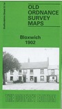
    This detailed map covers much of Bloxwich, north of Walsall, and also includes Little Bloxwich and Wallington Heath. Features include Elmore Green (at foot of map), Highfield House, section of railway (but no station), section of Wyrley & Essington Canal, Wallington House, Bloxwich Park, brewery, cemetery, old coal shafts, Baytree House, The Hills, Selmans Hill Farm etc. A Bloxwich Directory from the Walsall Red Book is also included on the reverse.

    The map links up with sheets 57.15 Pelsall South to the east, 63.02 Leamore to the south.


  • For a list of local maps, please go to the Walsall or West Midlands page.
  • You can order maps direct from our On-line Mapshop. For other information and prices, and other areas, go to The Index Page.
  • Maps in the Godfrey Edition are taken from the 25 inch to the mile map and reduced to about 15 inches to the mile. For a full list of maps for England, return to the England page.
    Alan Godfrey Maps, Prospect Business Park, Leadgate, Consett, Co Durham, DH8 7PW / sales@alangodfreymaps.co.uk / 28 January 2018