
 Here are the details of maps for Southend Village:

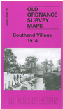
The Ordnance Survey did not include this area in their London Series until this edition and many would still regard it as part of Kent. The map covers the village of Southend, south of Catford, and even in 1914 it is largely rural. However at the north of the map building is taking place along Bellingham Road, while the tramway extends down to Southend, where new roads have been laid out. There is a stretch of railway down the western side of the map, with Bellingham and Beckenham Hill stations. There are several sports grounds, including Foxgrove Golf Course, and beyond that countryside. A slightly grey map (the fault of the original, not us) but fascinating for the way the area has changed. The author, John Coulter, comments that "It would be difficult to find a sheet of the 1914 Ordnance Survey, not purely rural, which shows so few buildings that are still standing. This is a sheet to enjoy in the home, perhaps, rather than as a tool for exploration". Our map also includes directories for Bellingham Road, Bromley Road and Southend.
The map links up directly with Sheets 129 Catford to the north and 138 Lower Sydenham to the west.
 Follow this link for a complete list of our London maps .