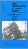
Somerset Sheet 65.05 Castle Cary & Ansford 1902 - published 2010; introduction by Tony Painter. ISBN.978-1-84784-388-3 
This detailed map covers most of the small town of Castle Cary, together with the adjacent village of Ansford. Coverage runs eastward to Honeywick and Hadspen Farm.
Features include Castle Cary town centre with all buildings neatly delineated, High Flax Mills, All Saints church, South Cary, Lodge Hill, castle site, George Hotel, Florida House, Jubille Cottages, Towns End,
Cumnock Terrace, Ansford House, St Andrew's church, Boyd's Hair Factory, Town Hall, Honeywick Hill, Priddle's Hill. On the reverse we include a 1902 directory for Castle Cary.
Follow this link for a list of our maps for Somerset or here for a general list for the South West.
You can order maps direct from our On-line Mapshop.
For other information and prices, and other areas, go to The Index Page.
Maps in the Godfrey Edition are taken from the 25 inch to the mile map and reduced to about 15 inches to the mile.
For a full list of maps for England, return to the England page.
Alan Godfrey Maps, Prospect Business Park, Leadgate, Consett, Co Durham, DH8 7PW / sales@alangodfreymaps.co.uk / 13 January 2018
 Here are the details of maps for Castle Cary: