Old Ordnance Survey Maps of Somerset

  • These detailed maps normally cover an area of about one and a half miles by one mile. Each map includes an introduction.
  • They are available through our On-line Mapshop

  • Here are the details of maps for Wells:

  • Somerset Sheet 41.05 Wells 1902 - published 1994; introduction by Alan Godfrey. ISBN.978-0-85054-644-6

    This detailed map provides good coverage of the Cathedral City of Wells. The map shows Keward to the west and stretches east to Tor Hill Quarry. Features include Wells Union Workhouse, the great Cathedral, St Cuthbert's Church, Hospital (for infectious diseases), Engineering Works and Gas Works. Wells had a complicated railway history and the map includes both GWR and Somerset & Dorset stations and engine sheds, with details of sidings, turntables etc. An extract from Kelly's Directory of Somerset is featured on the reverse.

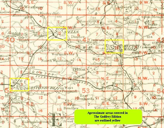
    You might find this index map useful.


  • Follow this link for a list of our maps for Somerset or here for a general list for the South West.
  • You can order maps direct from our On-line Mapshop. For other information and prices, and other areas, go to The Index Page.
  • Maps in the Godfrey Edition are taken from the 25 inch to the mile map and reduced to about 15 inches to the mile. For a full list of maps for England, return to the England page.
    Alan Godfrey Maps, Prospect Business Park, Leadgate, Consett, Co Durham, DH8 7PW / sales@alangodfreymaps.co.uk / 13 January 2018