 Here are the details of maps for Highbridge:

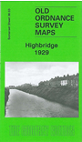
This detailed map is double-sided to provide maximum coverage, with a large section of adjacent sheet 38.04 on the reverse. Most of the town of Highbridge is included and major features include the town centre, Newtown, St John's church, Bacon Factory, Saw Mills, Highbridge Wharf, Patent Fuel Works, Apex Brick & Tile Works, Alstone, River Brue, Clyce Wharf, extending west to the point where the Brue enters the River Parrett. The backing map covers the east of the town, including railway station, Highbridge Junction, the Somerset & Dorset Locomotive & Carriage Works, Walrow Terrace, Bristol Bridge Brick Works. Coverage extends east to Hook Rhyne and Isleport Road. The detailed portrayal of the railway works will be of especial interest to transport historians.