 Here are the details of maps for Clevedon:


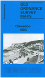
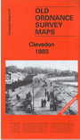
We have published two maps for Clevedon, showing how the town changed across the years. The 1883 version is in full colour, taken from the beautiful 1st Edition handcoloured OS map. Coverage stretches from Clevedon Bay, the pier, and Salthouse Bay eastward to East Clevedon and All Saints church.
Features include Clevedon Bay Pier, Salt House, Hangstone Quarry, Gas Works, railway station, All Saints' Church and Christ Church. The maps include extracts from early directories on the reverse.
Clevedon is famed most of all for its splendid pier. As a seaside resort it grew between 1850 and 1870 and still retains some of its genteel atmosphere today. It was also the terminus for two railways, the GWR's Clevedon branch and the Weston Clevedon & Portishead Light Railway; the GWR terminus is shown on the 1883 map, but the WCPLR station only came in time for the later map.