
 Here is information about Sheet 300:
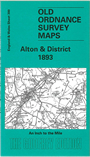
This Inch to the Mile map covers a large area of rural east Hampshire. Coverage stretches from Itchen Abbas eastward to Kingsley and Woolmer Forest, and from Preston Candover southward to Petersfield. Other towns on the map include Alton and New Alresford, and the map will therefore be of interest to railway enthusiasts for the restored Alton-Alresford line. Villages of note include Chawton, home to Jane Austen, and Selborne, where Gilbert White wrote his 'Natural History of Selborne'; on the reverse we include a more detailed map of Selborne, including 'The Wakes', White's home, and the Zigzag path he created up onto Selborne Hanger. A directory of Selborne in 1899 is also included.
It is not possible to list the many hamlets, farmsteads and other topographical features shown on these maps. However, you may find it useful if we list the towns and principal villages or church parishes that are included on this map. Links are given for those for which detailed large-scale maps are also available.
Index maps are available showing the areas covered by the Inch to the Mile maps. Go to This page
You can order maps direct from our On-line Mapshop. For a full list of Inch to the Mile maps go to the Inch to the Mile page, where you will also find details of prices. For information on the rest of the series, go to The Index Page.