Old Ordnance Survey Inch to the Mile Maps

  • These maps normally cover an area of about 18 miles by 12 miles and are especially good at showing railways, roads and canals, and at giving a broad view of a wider area. Each includes an introduction and a more detailed map of a small town or village. They are available through our On-line Mapshop

  • Here is information about Sheet 287:

  • One Inch Sheet 287 Sevenoaks & Tonbridge 1893 - published 2011; intro Barrie Trinder. ISBN.978-1-84784-445-3

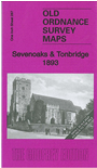
    This Inch to the Mile map covers the area from Limpsfield eastward to West Malling, and from Wrotham southward to Speldhurst. The major towns are Sevenoaks, Westerham and Tonbridge. Features include several railways, including the Westerham Branch. On the reverse we include a detailed map of the village of Wrotham.


    It is not possible to list the many hamlets, farmsteads and other topographical features shown on these maps. However, you may find it useful if we list the towns and principal villages or church parishes that are included on this map. Links are given for those for which detailed large-scale maps are also available.

  • Kent: Addington, Bidborough, Birling, Brasted, Brenchley, Capel, Chevening, Chiddingstone, Chipstead, Cudham, East Peckham, Edenbridge, Hadlow, Hever, Hildenborough, Ightham, Kemsing, Knockholt, Leigh, Limpsfield, Mereworth, Offham, Otford, Paddock Wood, Ryarsh, Seal, Sevenoaks, Shipborne, Southborough, Speldhurst, Sundridge, Tatsfield, The Weald, Titsey, Tonbridge, Trotterscliffe, Tudeley, West Malling, West Peckham, Westerham, Wrotham.
    For a full list of Inch to the Mile maps go to our One Inch page.

    You can order maps direct from our On-line Mapshop. For other information and prices, and other areas, go to The Index Page.


    The Godfrey Edition / godfreyedition@btinternet.com / 18 Jan 2011