
 Here is information about Sheet 273:
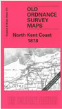
This map covers the North Kent Coast from Faversham to Reculver and Sarre, and also includes the eastern half of the Isle of Sheppey. The following towns are included: Faversam, Whitstable, Herne Bay. A section of the long closed Whitstable-Canterbury railway is shown. On the reverse we include a detailed map of Sarre, together with a short directory.
It is not possible to list the many hamlets, farmsteads and other topographical features shown on these maps. However, you may find it useful if we list the towns and principal villages or parishes that are included on this map:
Index maps are available showing the areas covered by the Inch to the Mile maps. Go to This page
You can order maps direct from our On-line Mapshop. For a full list of Inch to the Mile maps go to the Inch to the Mile page, where you will also find details of prices. For information on the rest of the series, go to The Index Page.