Old Ordnance Survey Inch to the Mile Maps

  • These maps normally cover an area of about 18 miles by 12 miles and are especially good at showing railways, roads and canals, and at giving a broad view of a wider area. Each includes an introduction and a more detailed map of a small town or village. They are available through our On-line Mapshop

  • Here is information about Sheet 234:

  • One Inch Sheet 234 Gloucester & District 1896 - published 2009; intro by Barrie Trinder. ISBN.978-1-84784-222-0

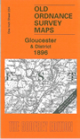
    This Inch to the Mile map covers the area around and to the south of Gloucester, with coverage westward to Mitcheldean, southward to Sharpness Dock, eastward to Leckhampton. Features include the River Severn, Shapness Dock and Severn Bridge, Gloucester & Berkeley Canal, railways incl parts of Nailsworth Branch and Hereford & Gloucester line, etc. Gloucester is the main urban feature but smaller towns shown include Stroud, Painswick, Blakeney, Newnham and Mitcheldean. On the reverse we include a detailed map of Painswick.

    It is not possible to list the many hamlets, farmsteads and other topographical features shown on these maps. However, you may find it useful if we list the towns and principal villages or church parishes that are included on this map. Links are given for those for which detailed large-scale maps are also available.

  • Gloucestershire: Arlingham, Badgeworth, Barnwood, Bisley, Blaisdon, Blakeney, Brimsfield, Brockworth, Brookthorpe, Bulley, Chalford, Churcham, Churchdown, Cranham, Eastington, Edgeworth, Elmore, Flaxley, Frampton upon Severn, Fretherne, Frocester, Gloucester, Great Shurdington, Great Witcombe, Hardwicke, Harescombe, Haresfield, Hempsted, Highnam, Hinton, Hucclecote, Huntley, Kings Stanley, Leckhampton, Leonard Stanley, Little Dean, Longhope, Longney, Matson, Minsterworth, Miserden, Mitcheldean, Moreton Valence, Newnham, Painswick, Pitchcombe, Quedgeley, Randwick, Rodborough, Sapperton, Saul, Sharpness Docks, Slimbridge, Standish, Stonehouse, Stroud, Tuffley, Upton St Leonards, Westbury upon Severn, Whaddon, Woodchester, Wotton St Mary Without.

    Index maps are available showing the areas covered by the Inch to the Mile maps. Go to This page


    You can order maps direct from our On-line Mapshop. For a full list of Inch to the Mile maps go to the Inch to the Mile page, where you will also find details of prices. For information on the rest of the series, go to The Index Page.


    Alan Godfrey Maps, Prospect Business Park, Leadgate, Consett, Co Durham, DH8 7PW / sales@alangodfreymaps.co.uk / 16 April 2011