
 Here is information about Sheet 192 & 209:
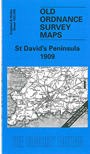
This Inch to the Mile map covers the NW area of Pembrokeshire around the tiny cathedral city of St David's. The two maps are effectively joined as one. Coverage stretches from Ramsey Island and St David's Head eastward to Hayscastle and St Nicholas, and from Strumble Head southward to Brawdy. The little range of offshore islands known as the Bishops and Clerks are also on the map. On the reverse we include an extract from Pembrokeshire Sheet 21.01 and this covers the little port of Solva in detail; it includes Lower Solva and Upper Solva, together with a directory.
It is not possible to list the many hamlets, farmsteads and other topographical features shown on these maps. However, you may find it useful if we list the towns and principal villages or church parishes that are included on this map:
Index maps are available showing the areas covered by the Inch to the Mile maps. Go to This page
You can order maps direct from our On-line Mapshop. For a full list of Inch to the Mile maps go to the Inch to the Mile page, where you will also find details of prices. For information on the rest of the series, go to The Index Page.