
Old Ordnance Survey Inch to the Mile Maps
These maps normally cover an area of about 18 miles by 12 miles and are especially good at showing railways, roads and canals, and at giving
a broad view of a wider area. Each includes an introduction and a more detailed map of a small town or village.
They are available through our On-line Mapshop
 Here is information about Sheet 159:
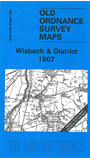
One Inch Sheet 159 Wisbech & District 1907 - published 2007; intro by Robert Malster. ISBN.978-1-84784-073-8
This Inch to the Mile map covers parts of Cambridgeshire and Norfolk; coverage stretches from March (which is in the SW corner) northward to Tilney St Lawrence and eastward to Fincham. Features include the River Ouse, Old
Bedford River, New Bedford River, Sixteen Foot Drain, Popham's Eau and River Nene, which all flow through the map. Wisbech and Downham Market are included in this fenland map, as are various now closed railways around Wisbech. On
the reverse we include a detailed map of the village of Crimplesham, with a directory.
Cambridgeshire: Leverington, March, Newton, Outwell, Wisbech, Wisbech St Mary.
Norfolk: Crimplesham, Denver, Downham Market, Elm, Emneth, Fincham, Hilgay, Nordelph, Runcton Holme, Setchey, Shouldham, Shouldham Thorpe, South Runcton, Stow Bardolph, Stowbridge, Stradsett, Tilney St Lawrence,
Tottenhill, Upwell, Walsoken, Watlington, Wereham, West Walton, West Dereham, Wiggenhall St Germans, Wiggenhall St Mary Magdalen, Wiggenhall St Mary the Virgin, Wiggenhall St Peter, Wimbotsham, Wormegay, Wretton.
Index maps are available showing the areas covered by the Inch to the Mile maps. Go to This page
You can order maps direct from our On-line Mapshop. For a full list of Inch to the Mile maps go to the Inch to the Mile page,
where you will also find details of prices. For information on the rest of the series, go to The Index Page.
Alan Godfrey Maps, Prospect Business Park, Leadgate, Consett, Co Durham, DH8 7PW / sales@alangodfreymaps.co.uk / 16 April 2011