
 Here is information about Sheet 151:
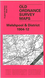
This One Inch to the Mile map covers that lovely area of the Marches west of Shrewsbury, and the map is almost equally divided between Shropshire and Montgomeryshire or Powys. Coverage stretches from Llanfair Caereinion eastward to Minsterley and the Stiperstones. The River Severn and the Cambrian Railway run through the map, which also shows the much loved Welshpool & Llanfair Light Railway. Keen eyed railway historians will also find a stretch of the Shropshire & Montgomery Railway's Breiddon branch, as well as a fragment of the mineral line to Snailbeach. On the reverse we include an extract from Montgomeryshire Sheet 22.10, showing Llanfair Caereinion in 1901.
It is not possible to list the many hamlets, farmsteads and other topographical features shown on these maps. However, you may find it useful if we list the towns and principal villages or church parishes that are included on this map. Links are given for those for which detailed large-scale maps are also available.
Index maps are available showing the areas covered by the Inch to the Mile maps. Go to This page
You can order maps direct from our On-line Mapshop. For a full list of Inch to the Mile maps go to the Inch to the Mile page, where you will also find details of prices. For information on the rest of the series, go to The Index Page.