
Old Ordnance Survey Inch to the Mile Maps
These maps normally cover an area of about 18 miles by 12 miles and are especially good at showing railways, roads and canals, and at giving
a broad view of a wider area. Each includes an introduction and a more detailed map of a small town or village.
They are available through our On-line Mapshop
 Here is information about Sheet 87:
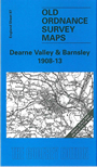
One Inch Sheet 87 Dearne Valley & Barnsley 1908-13 - published 2001; intro by Melvyn Jones. ISBN.978-1-84151-232-7
This Inch to the Mile map covers the area from Stocksbridge eastward to Adwick le Street, and from Royston southward to Rawmarsh and the northern outskirts of Rotherham. The
principal town on the map is Barnsley, and the map is notable for its mining towns and for the many railways that cross the area. On the reverse we include a map of Grimethorpe in 1904, an interesting
contrast with the fuller map of Grimethorpe in 1929 also available in the series.
It is not possible to list the many hamlets, farmsteads and other topographical features shown on these maps. However, you may find it useful if we list the towns and
principal villages or church parishes that are included on this map. Links are given for those for which detailed large-scale maps are also available.
Yorkshire: Adwick le Street, Adwick upon Dearne, Ardsley, Barnbrough, Barnsley, Barugh, Billingley, Bolton-upon-Dearne, Braithwell, Brierley, Brodsworth,
Burghwallis, Cadeby, Carlton, Cawthorne, Conisbrough, Cudworth, Darfield, Darton, Denaby, Dodworth, Ecclesfield, Edlington, Greasbrough, Great Houghton, Hampole, Hickelton,
High Hoyland, High Melton, Hooton Pagnell, Hooton Roberts, Hoyland Nether, Hoyland Swaine, Kexbrough, Little Houghton, Marr, Mexborough, Monk Bretton, Oxspring, Ravenfield, Rawmarsh, Royston,
Shafton, Silkstone, Skelbrooke, Skellow, South Hiendley, South Kirkby, Sprotbrough, Stainbrough, Stocksbridge, Swinton, Tankersley, Thrybergh, Thurgoland, Thurnscoe,
Warmsworth, Wath upon Dearne, Wentworth, West Melton, Wombwell, Wortley.
Index maps are available showing the areas covered by the Inch to the Mile maps. Go to This page
You can order maps direct from our On-line Mapshop. For a full list of Inch to the Mile maps go to the Inch to the Mile page,
where you will also find details of prices. For information on the rest of the series, go to The Index Page.
Alan Godfrey Maps, Prospect Business Park, Leadgate, Consett, Co Durham, DH8 7PW / sales@alangodfreymaps.co.uk / 16 April 2011