
Old Ordnance Survey Inch to the Mile Maps
These maps normally cover an area of about 18 miles by 12 miles and are especially good at showing railways, roads and canals, and at giving
a broad view of a wider area. Each includes an introduction and a more detailed map of a small town or village.
They are available through our On-line Mapshop
 Here is information about Sheet 64:
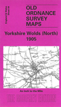
One Inch Sheet 64 Yorkshire Wolds (North) 1905 - published 2002; intro by David & Susan Neave. ISBN.978-1-84151-419-2
This One Inch to the Mile map covers the area from Fridaythorpe and Huggate Wold eastward to Burton Agnes; and from Langtoft and Tog Dale southward to Cranswick and North Dalton. Great Driffield, near the centre of the map,
is the only town shown, though there are many small villages. On the reverse we include a detailed map of Wetwang,together with a directory.
It is not possible to list the many hamlets, farmsteads and other topographical features shown on these maps. However, you may find it useful if we list the towns and
principal villages or church parishes that are included on this map. Links are given for those for which detailed large-scale maps are also available.
Yorkshire: Bainton, Beeford, Brigham, Burton Agnes, Cottam, Cowlam, Duggleby, Eastburn, Fimber, Foston on the Wolds, Fridaythorpe,
Garton on the Wolds, Gembling, Gransmoor, Great Driffield, Great Kelk, Haisthorpe, Harpham,
Huggate, Kilham, Kirby Grindalythe, Langtoft, Little Kelk, Lowthorpe, Nafferton, Neswick, North Dalton, North Frodingham, Rotsea, Rudston, Ruston Parva,
Skerne, Sledmere, Southburn, Thornholme, Tibthorpe, Towthorpe, Wansford, Wetwang, Wharram le Street, Wharram Percy
Index maps are available showing the areas covered by the Inch to the Mile maps. Go to This page
You can order maps direct from our On-line Mapshop. For a full list of Inch to the Mile maps go to the Inch to the Mile page,
where you will also find details of prices. For information on the rest of the series, go to The Index Page.
Alan Godfrey Maps, Prospect Business Park, Leadgate, Consett, Co Durham, DH8 7PW / sales@alangodfreymaps.co.uk / 16 April 2011